In the field of trenchless underground pipeline positioning, the Inertial Navigation Pipeline 3D Measuring Instrument(gyro mapping system) (also known as the pipeline gyroscope, pipeline 3D trajectory mapping system, or pipeline locator ) is a high-precision measuring device based on inertial navigation technology. It utilizes advanced sensor technology to accurately measure the three-dimensional attitude and position information of pipelines, and is widely used in industries such as oil, natural gas, and urban pipeline networks. This article will provide a detailed introduction to its working principles, features, and application scenarios, and explain its relationship with other names that may be used.
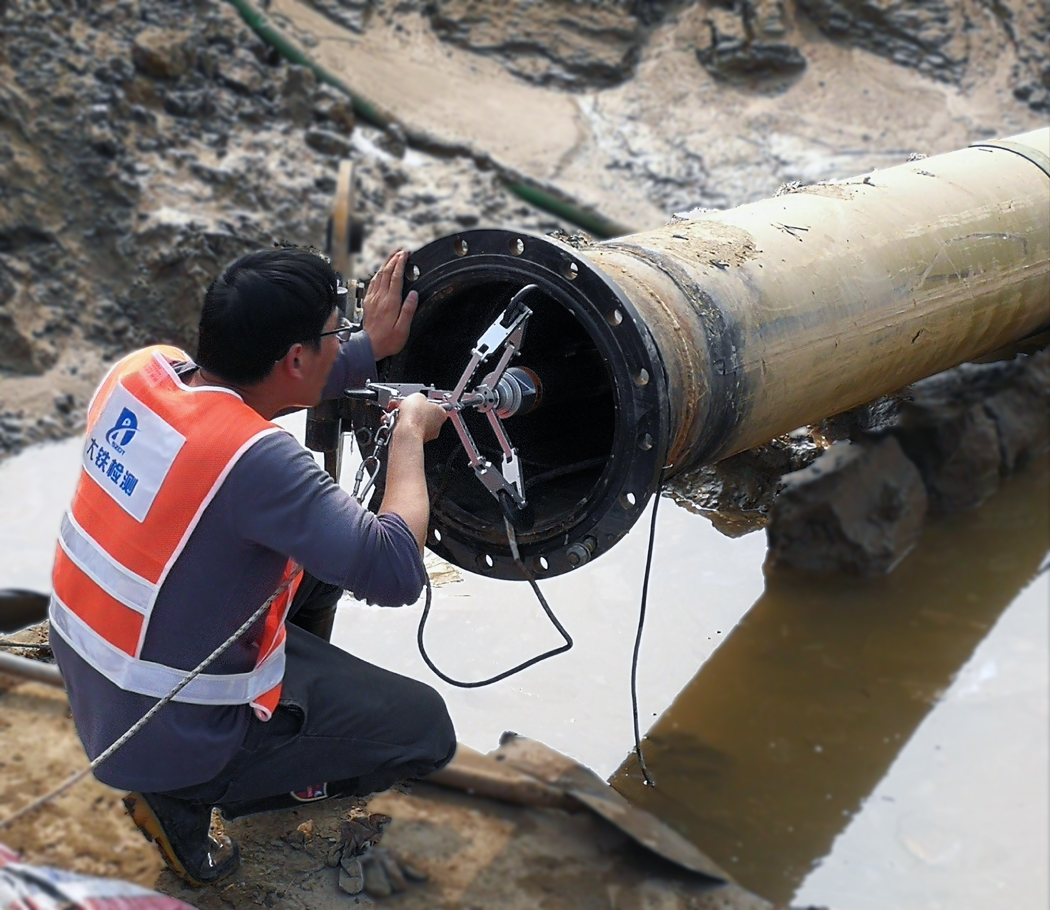
I. Working Principles of the Inertial Navigation Pipeline 3D Measuring Instrument
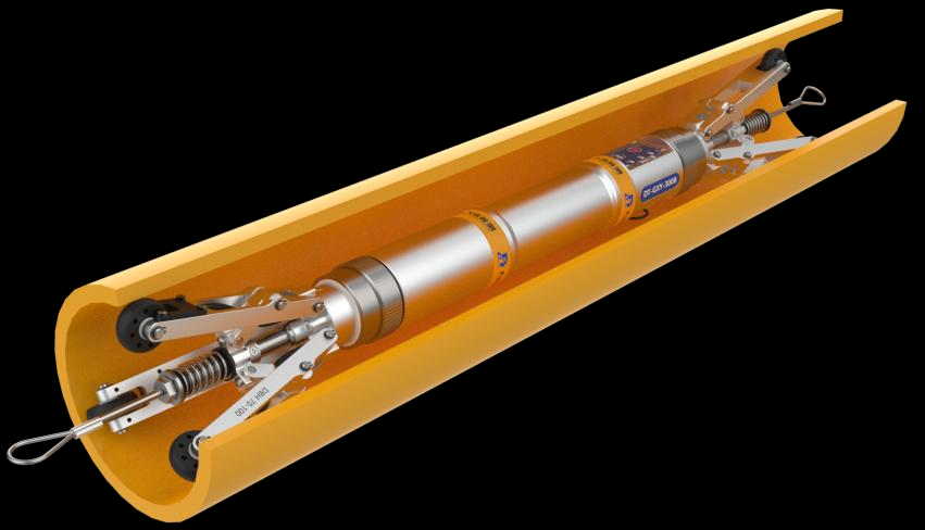
The core technology of the Inertial Navigation Pipeline 3D Measuring Instrument is the inertial navigation system, which mainly consists of a gyroscope and an accelerometer. Its working principles are as follows:
1. Gyroscope: Measures the angular velocity of the device in three-dimensional space to determine changes in the pipeline's attitude (such as tilt, rotation, etc.).
2. Accelerometer: Measures the linear acceleration of the device and calculates displacement through integration, thereby determining the pipeline's motion trajectory.
3. Data Fusion: Algorithms fuse the data from the gyroscope and accelerometer to generate the pipeline's three-dimensional attitude and position information.
Unlike traditional pipeline locators, the Inertial Navigation Pipeline 3D Measuring Instrument is not affected by pipeline burial depth, material, or electromagnetic interference, enabling high-precision measurements in complex environments.
II. Features of the Inertial Navigation Pipeline 3D Measuring Instrument
1. High Precision: Utilizes advanced inertial navigation technology to achieve millimeter-level precision in pipeline 3D measurements.
2. Strong Adaptability: Unaffected by pipeline burial depth, material, soil conditions, or electromagnetic interference, making it suitable for various complex environments.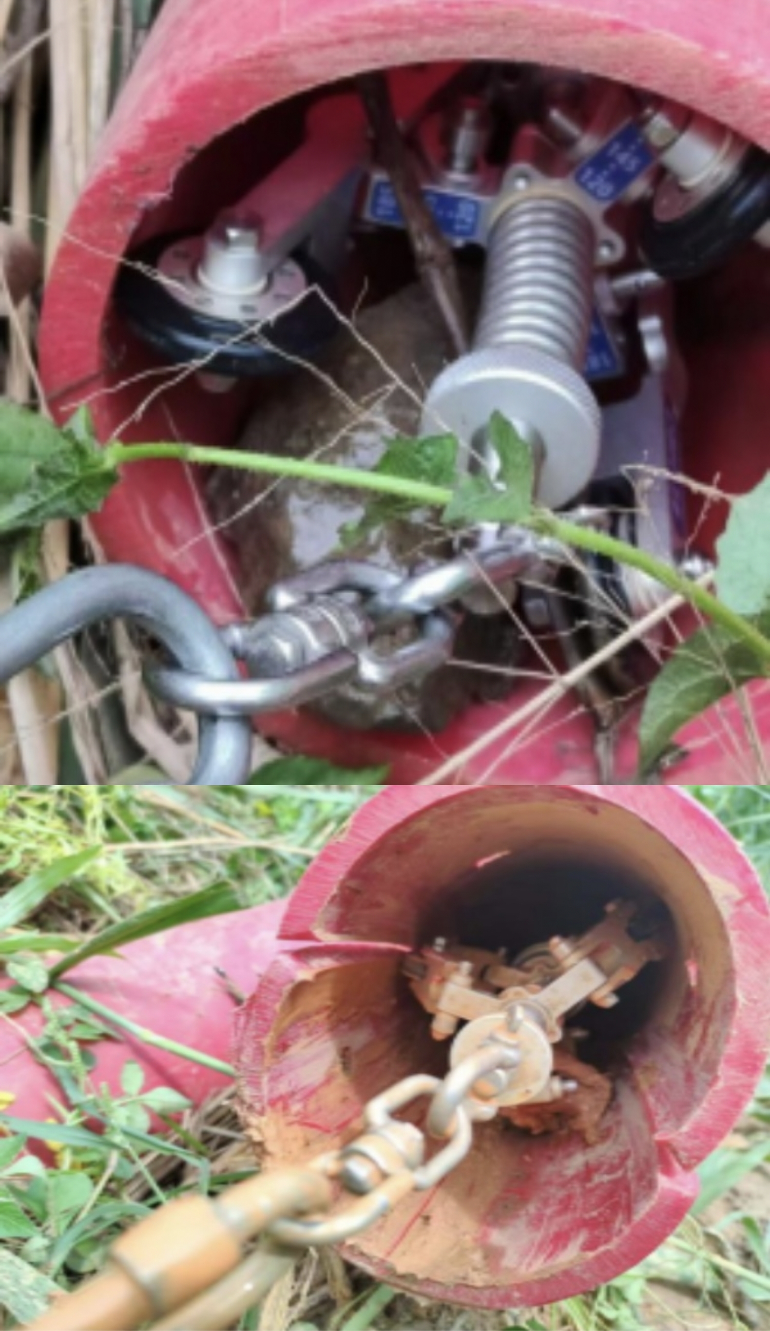
3. Efficient and Convenient: The device is compact, lightweight, easy to operate, and capable of quickly completing pipeline measurement tasks.
4. Comprehensive Data: Not only measures pipeline position but also provides pipeline attitude information (such as tilt angle, curvature, etc.).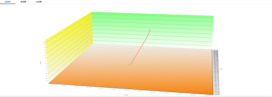
5. Strong Compatibility: Can seamlessly integrate with GIS systems and pipeline design software, facilitating data analysis and application.
III. Application Scenarios of the Inertial Navigation Pipeline 3D Measuring Instrument
1. Oil and Gas Pipeline Inspection:
- Used to measure the 3D trajectory of long-distance oil and gas pipelines to ensure safe operation.
- Detects pipeline deformation, subsidence, and other issues, providing data support for maintenance and repair.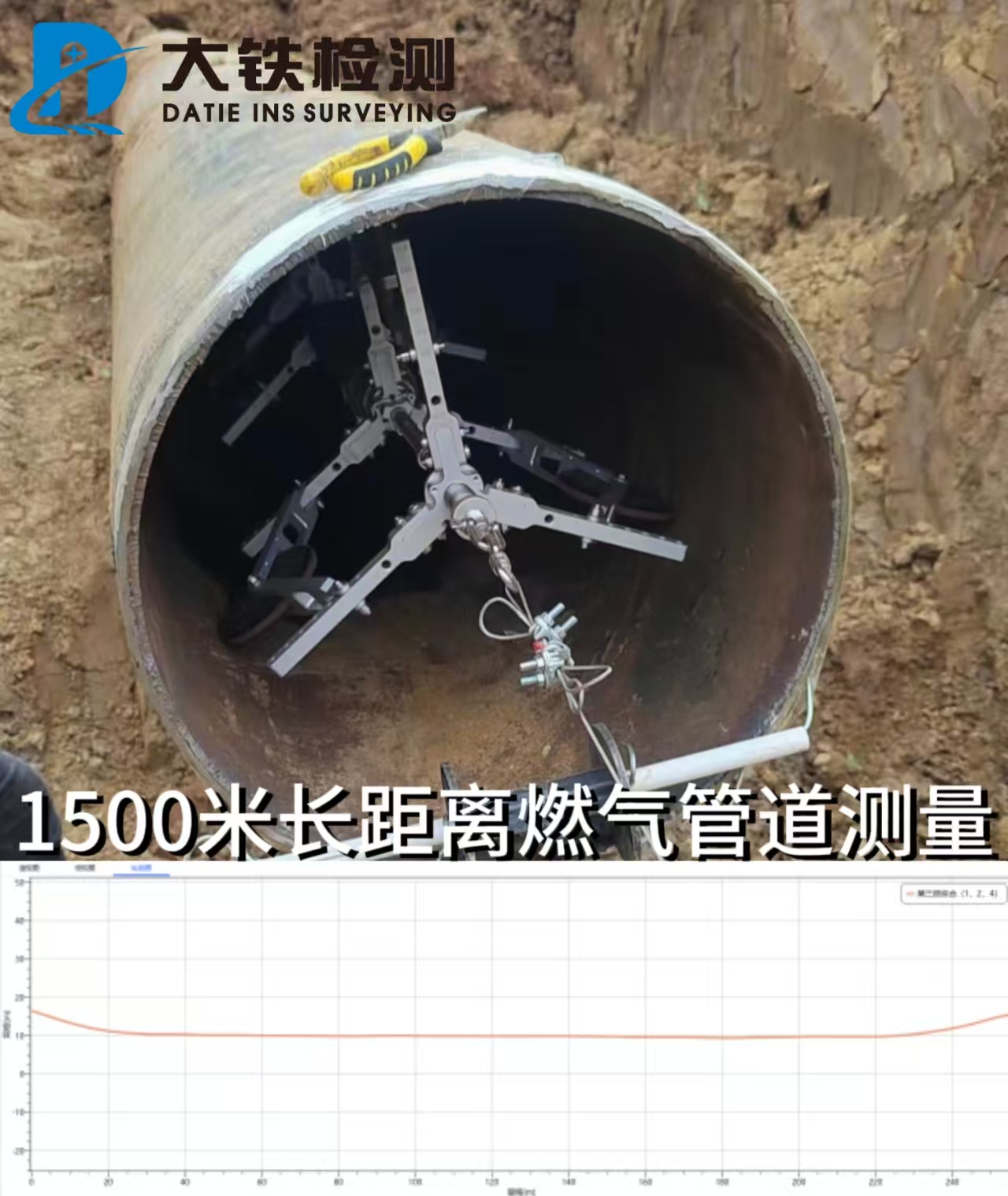
2. Urban Underground Pipeline Network Measurement:
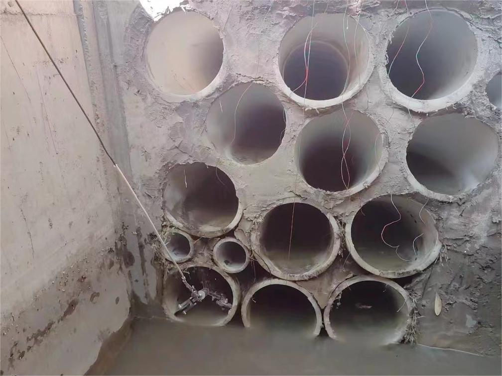
- Measures the direction and depth of urban pipeline networks (such as water supply, drainage, and gas pipelines) to provide foundational data for urban planning.
- Addresses complex underground environmental challenges that traditional measurement methods struggle to handle.
3. Industrial Pipeline Installation and Maintenance:
- Used in industrial settings such as chemical plants and power plants to measure pipeline installation accuracy and operational status.
- Helps engineers quickly locate pipeline issues, improving maintenance efficiency.
4. Trenchless Construction:
- Used in trenchless construction (e.g., horizontal directional drilling) to monitor the drilling trajectory of pipelines in real time, ensuring construction accuracy.
IV. Relationship Between the Inertial Navigation Pipeline 3D Measuring Instrument and Other Names
In practical applications, different names may be used to refer to the Inertial Navigation Pipeline 3D Measuring Instrument. Below is an explanation of the relationships between these names:
1. Pipeline Gyroscope:
- Since the core component of the Inertial Navigation Pipeline 3D Measuring Instrument is the gyroscope, it is often referred to as the "pipeline gyroscope" by customers.
- This name highlights the core technological feature of the device.
2. Pipeline 3D Trajectory Mapping System:
- This name emphasizes the device's function, which is to achieve positioning by measuring the pipeline's 3D trajectory.
- It is fully consistent with the functionality of the Inertial Navigation Pipeline 3D Measuring Instrument.
 3. Pipeline Locator:
- This is a general term for devices used to measure pipeline positions.
- The Inertial Navigation Pipeline 3D Measuring Instrument is one type of high-precision pipeline locator.
4. Gyroscope:
- The gyroscope is one of the core components of the Inertial Navigation Pipeline 3D Measuring Instrument, so customers may directly refer to the device as a "gyroscope."
- However, it should be noted that the gyroscope is only a part of the device, not the entire system.
V. Conclusion
The Inertial Navigation Pipeline 3D Measuring Instrument (also known as the pipeline gyroscope, pipeline 3D trajectory mapping system, or pipeline locator) is a high-precision measuring device based on inertial navigation technology. It features high precision, strong adaptability, and efficiency, and is widely used in industries such as oil, natural gas, and urban pipeline networks, providing reliable technical support for pipeline installation, inspection, and maintenance.
By understanding its working principles, features, and application scenarios, the value of this device can be better appreciated. Regardless of the name used, the Inertial Navigation Pipeline 3D Measuring Instrument is an indispensable tool in modern pipeline measurement.